

7.31.20 2 p.m.
Two to four inches of rain are expected beginning Sunday into Tuesday.
Hurricane Isaias slowed slightly and shifted a bit to left Friday (today), the National Weather service said in its 1 p.m. briefing.
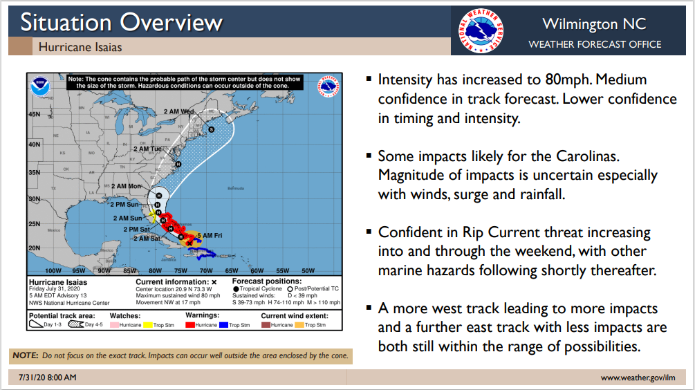
The Category One storm could bring high winds and heavy rains to Southeastern North Carolina beginning Sunday, but the bulk of the impacts are expected Monday into Tuesday.
Two to four inches of rain are currently forecast for the area, but a westward shift could increase those amounts.
The storm is expected to move through fairly quickly, Meteorologist Rick Neuherz said.
While even a tropical storm can be serious, Neuherz pointed out that Isaias is not a Matthew or Florence level event.
“We can expect river flooding in the usual lowlying areas, and there’s a 30 percent chance or greater of tropical storm force winds in the inland counties (based on the current track),” he said.
The worst of the impact from Isaias is still expected to remain along the coastal areas, Neuherz said. A full moon and high tides could lead to additional flooding in coastal tidewater areas.
City and county officials said preparations are underway across Columbus County.
Kay Worley of Columbus County Emergency Management said the county is readying emergency shelters if they are needed, but residents who might need to evacuate are encouraged to go inland instead.
“Due to the need for social distancing, we won’t be able to house as many people if we have to use cots,” she said. “We hope people will leave the area if they have to evacuate, so we can have the shelter space available for those with fewer resources.”
Hal Lowder of the City of Whiteville said Public Works crews are clearing drains and ditches in the city’s stormwater system. Some improvements had already been made in the wake of past flooding events, and the work is continuing. The city has also acquired extra generators and emergency equipment that Lowder said the city hopes never to use.
“If you live in a floodprone area, make your plans now,” Lowder said. “We need to have shelter space for people who have no choice. Double-check your emergency supplies.”
The NWS will have an updated briefing at 6 p.m. Columbuscountynews.com will have continuing coverage of the storm preparations and the hurricane on our website.
You can send us your closings and delays at [email protected], and share them on our Facebook page.